Understanding the Complex Hydrology of Semi-Arid Central Asia
February 15, 2022
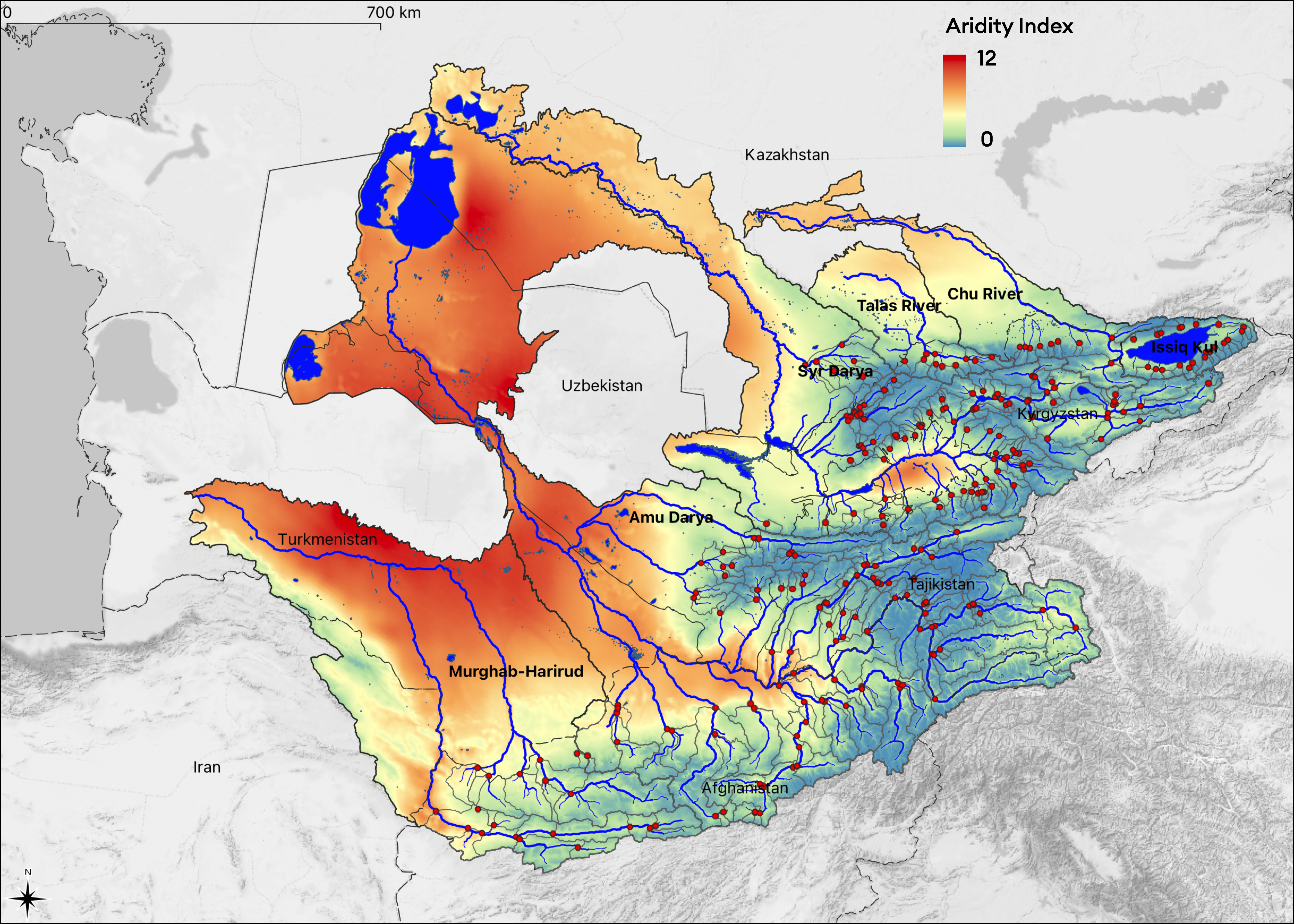
From a hydrological perspective, semi-arid Central Asia is a region of immense contrasts. On its south-eastern fringe are the large mountain ranges, including the Hindu Kush, the Pamir, the Gissar-Alay, and the Tien Shan. From there, the major rivers of the region emerge, including the Harirud and Murghab rivers, the Amu Darya and the Syr Darya as part of the Aral Sea basin, and finally, the Chu River and Talas River (Figure 1). These rivers are mostly snow melt-fed, with peak discharge occurring during the warm boreal summer months. During the irrigation season, much of the annually available water gets allocated for agricultural production in the downstream. This has allowed the region to prosper for millennia and led to the Aral Sea’s desiccation in the second half of the 20th century after irrigation systems saw a significant expansion in the area.
hydrosolutions GmbH (HSOL) is the lead expert agency on hydrology and remote sensing in the EU Horizon 2020 Hydro4U project. The team has more than 15 years of experience in the region. Additionally, it draws on a significant pool of local experts to unravel the fascinatingly complex hydrology in Central Asia on the one hand and to study in detail climate impacts there, with a focus on implications for the development of sustainable small-scale hydropower solutions in the highlands there.

As a foundation for the estimation of the small-scale hydropower potential (< 10 MW) in Central Asia, HSOL has worked to retrieve from different archives the locations and streamflow characteristics of close to 300 operational and historic gauges in the river basins (see red dots in Figure 1). Geolocating these was a significant task that required the consultation of different complementary sources. A meticulous workflow was established for cross-validating the identified gauge locations. All this was necessary because no such database exists in the region due to the lack of the tradition to work with geospatial data.
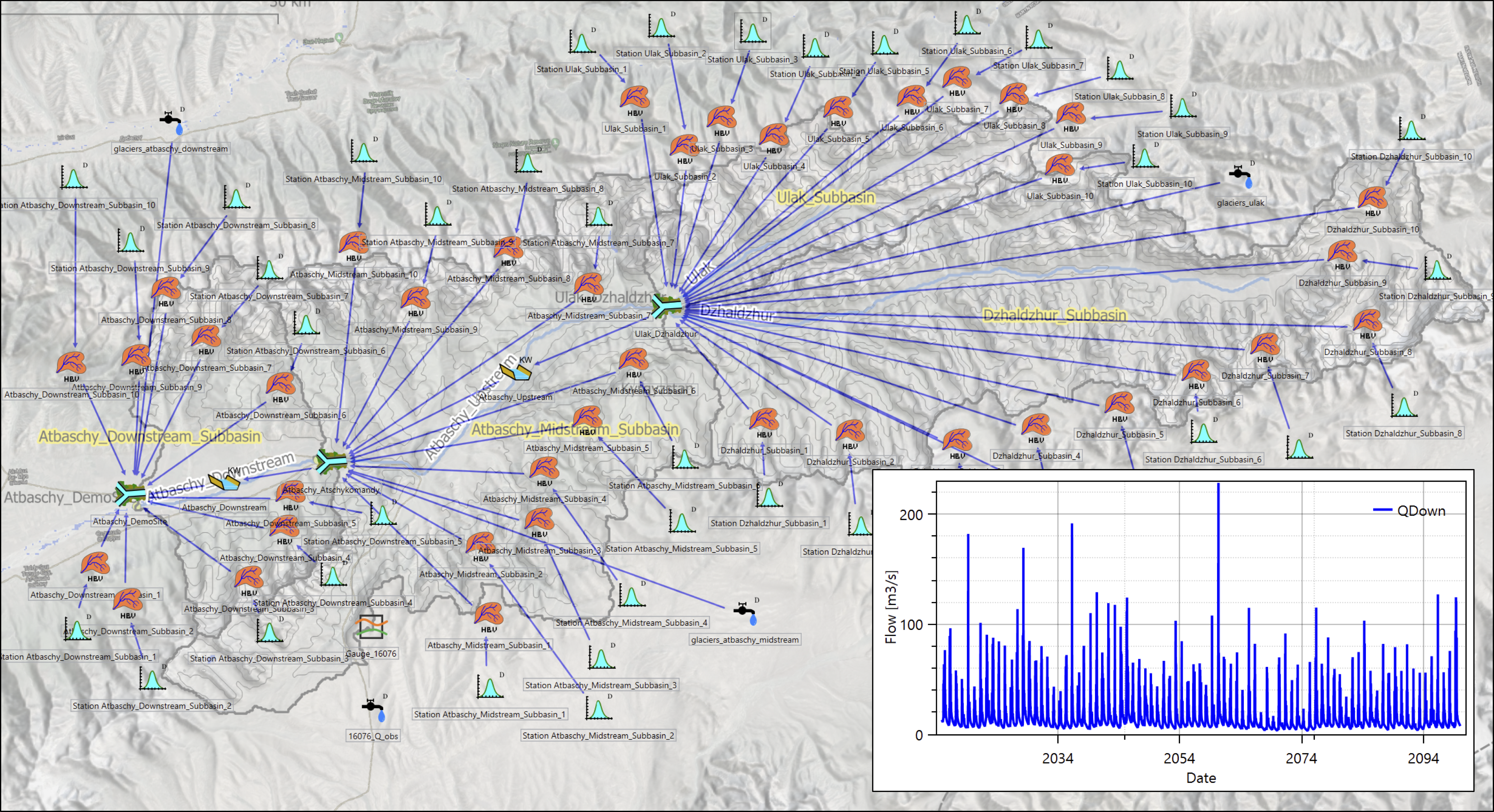
For all gauges, the contributing catchment areas were mapped. Many topographic/land-cover and (bio-)climatological characteristics, as well as information on land ice, are extracted from the latest state-of-the-art data sets. Climate forcing from four CMIP6 models and four scenarios was bias-corrected and downscaled to study in detail the climate impacts in the region and the implications for small-scale hydropower in the mountainous zones. Detailed hydrological studies are carried out at several sites of interest to inform, among other things, the proper dimensioning of the planned hydropower infrastructure and ecological minimum flows (Figure 2).

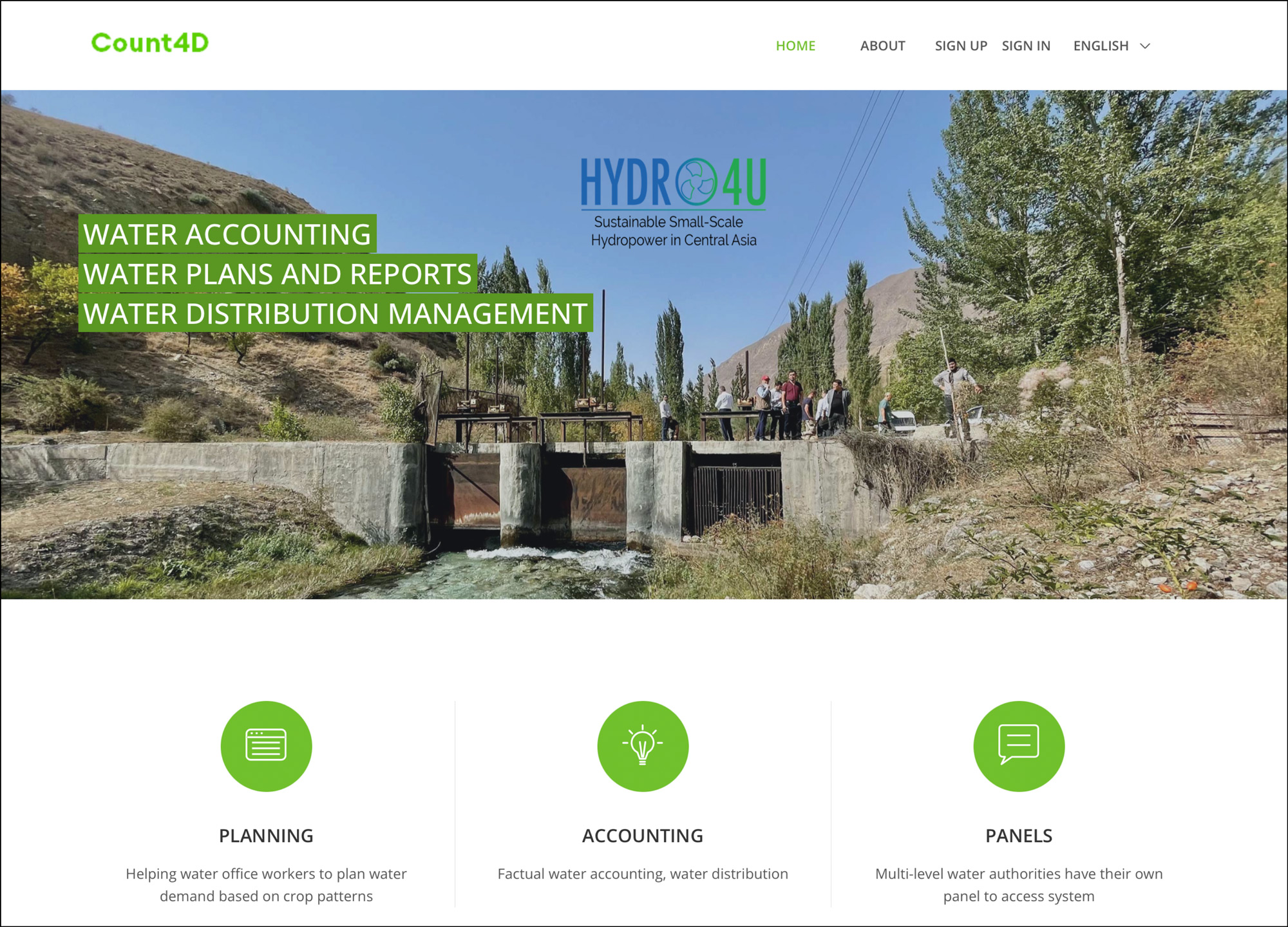
Finally, HSOL is co-designing with local stakeholders and implementing a water planning and accounting tool for comprehensive quantitative studies of the water, energy and food nexus dimensions in catchments of interest. Once operational in local agencies, this tool has the potential to streamline existing planning and accounting workflows and make them less error-prone and time-consuming, which may also lead to an overall improvement of the allocation of scarce water resources (Figure 3).

This is just the beginning of an exciting journey to further unravel the hydrology of the Central Asian region and to gain a proper, solid understanding of how best to develop the local water resources in a sustainable and ecologically sensitive manner for the ultimate benefit of the local population. Stay tuned for more news on this channel. More information can also be found on the website of hydrosolutions GmbH.
Author: Tobias Siegfried, hydrosolutions GmbH
Partner Description: hydrosolutions GmbH
Website: www.hydrosolutions.ch
LinkedIn: hydrosolutions.ch
Facebook: @hydrosolutions.gmbh
Twitter: @H2O_SOL
