In Central Asia, allocation conflicts between large-scale hydropower (HP) in the upstream countries and irrigation in the downstream occur regularly and mostly across complex international borders, especially during water scarce years and low storage conditions. With an increasing attention on the Sustainable small-scale hydropower production, the Water – Food – Energy– Climate (WFEC) Nexus is now under renewed focus in the Region.
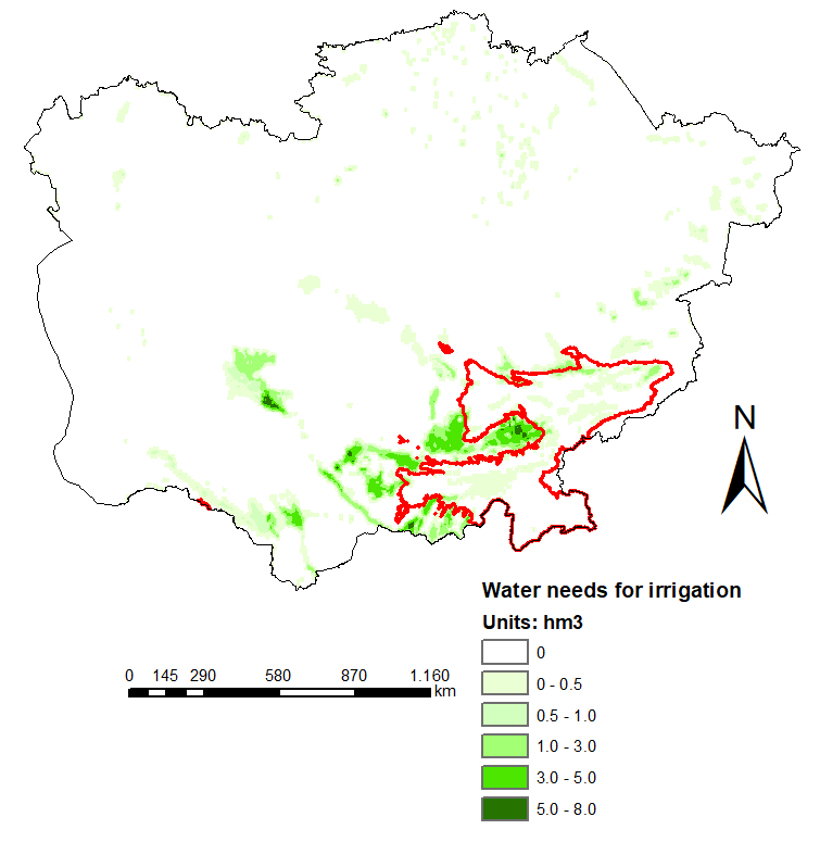
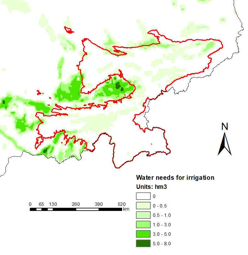
In line with these developments, CARTIF has conducted a geo-localized analysis of the agriculture water withdrawal in the Region. This water consumption is a crucial element of the WFEC Nexus studies as it directly impacts into the downstream water availability affecting HP potential.
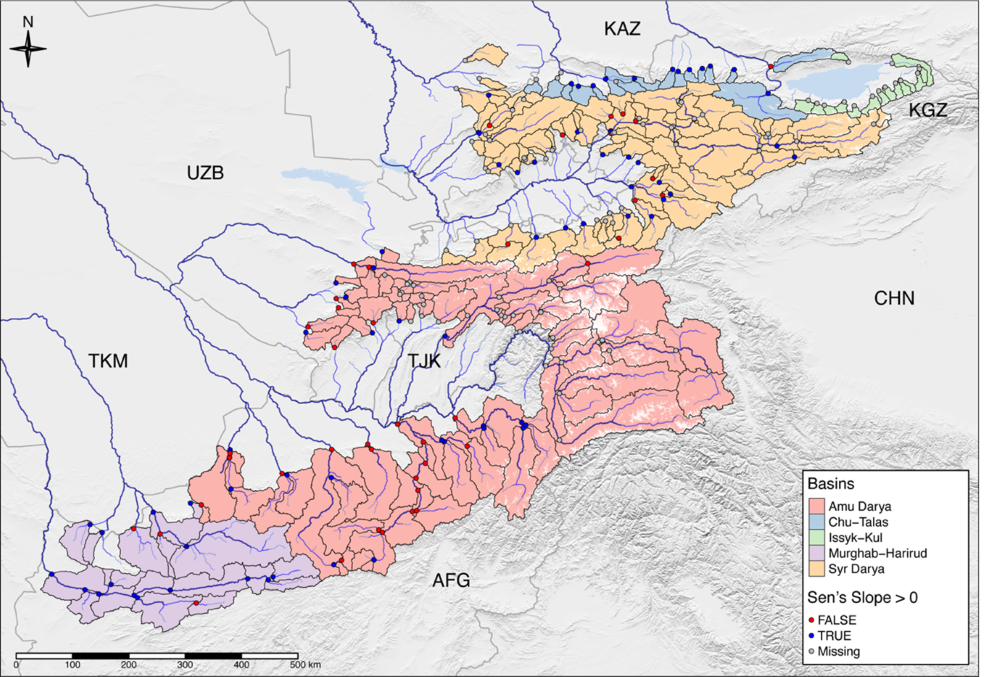
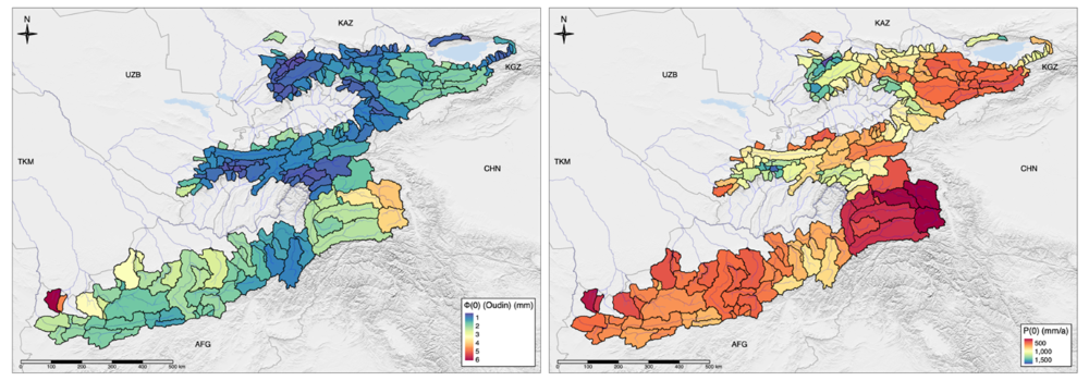
While crop production data at the national level are reported by the Food and Agriculture Organization of United Nations (FAO), similar data within sub-national boundaries or river basin scale are rarely available, and not from one institution. In the absence of official statistical data at the basin level, CARTIF’s GIS assessment has been based on the Spatial Production Allocation Model (MapSPAM) [1]. MapSPAM provides open access data on 42 different crop types and its management practices at 10 km of spatial resolution on an annual basis from 2000, 2005 and 2010. Each pixel in the region is associated to a harvested irrigated area and a specific crop yield. The latter can be transformed into agricultural water withdrawal rates by means of the water requirements for each crop type, identified in relevant publications [2-5]. Following this methodology, it has been possible to compute the agricultural water consumption in Central Asia and in the zone of runoff formation (ZRF), an area located in the mountainous territories and which concentrates the higher HP potential in Central Asia [6], as it is shown in Figure 1.

